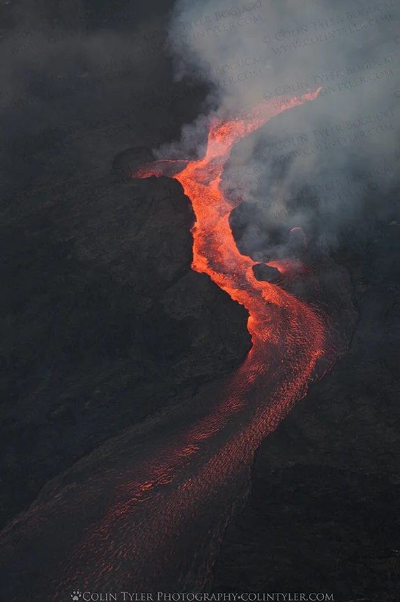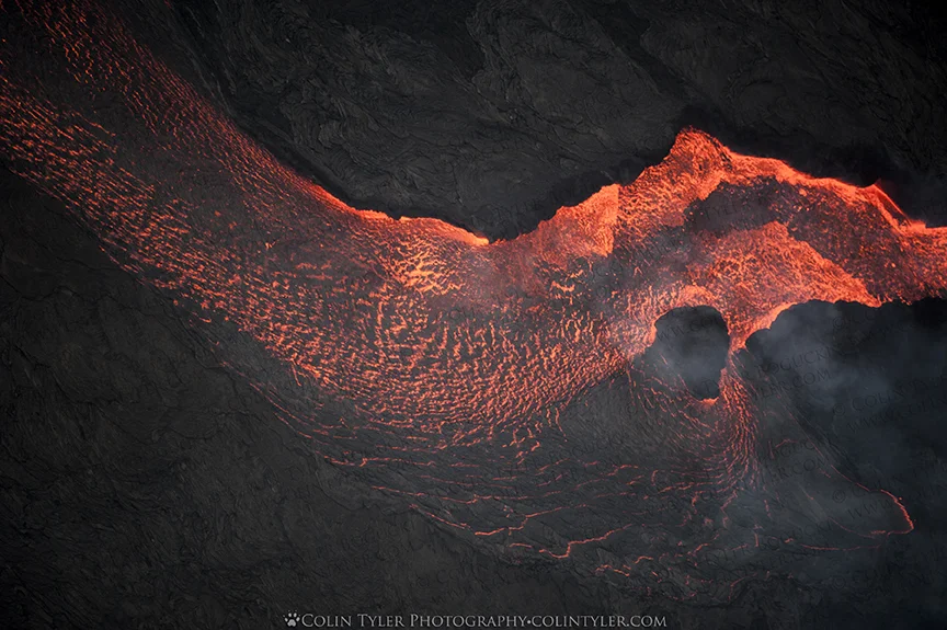
Here are the last of my aerial photos of the lava river in Lower Puna, Hawaii and its path of destruction. You can see the source, Fissure 8, where the lava is spewing from the ground and has created cone that stands 180 feet tall. From what I understand, this fissure and resulting cone are on private property, so if the residents return they will have a giant volcanic cone in their yard - not many people can make that claim! It's tough to put into words what I was witnessing, the only thing I can compare it to is a raging glacial river, much like the one near my home in Eagle River Valley, Alaska. I'd always imagined lava slowly creeping across the ground until it cools and solidifies but this was anything but slow or creeping. The flow was turbulent and splashing its way toward the ocean, moving at speeds of 17 MPH near the fissure. Once again, mahalo to Paradise Helicopter Tours of Hilo for this opportunity to observe and photograph such a rare, spectacular event and most of all, best wishes to the residents of Leilani Estates and all of the areas affected, as well as all the people on the Big Island of Hawaii, whose lives and livelihoods have been greatly impacted.
Aloha,
Colin